Mapping underground utilities in 3D
How can we map reliable 3D underground utility networks and use them in land administration? A framework for utility data goverance was published in Remote Sensing.
With the pressure of the increasing density of urban areas, some public infrastructures are moving to the underground to free up space above, such as utility lines, rail lines and roads. In the big data era, the three-dimensional (3D) data can be beneficial to understand the complex urban area.
Compared to spatial data and information of the above ground, there is a lack of precise and detailed information about underground infrastructures, such as the spatial information of underground infrastructure, the ownership of underground objects and the interdependence of infrastructures in the above and below ground. How can we map reliable 3D underground utility networks and use them in land administration?
The Digital Underground project at the Singapore-ETH Centre developed a framework for utility data governance to manage the work process from the underground utility data capture to data usage. The paper external page Towards an Underground Utilities 3D Data Model for Land Administration by researchers Dr Jingya Yan and Dr Jaw Siow Wei, principal investigator Prof Andreas Wieser, Kean Huat Soon from the Singapore Land Authority (SLA), and Dr Gerhard Schrotter, was published in Remote Sensing. This framework is backbone to support the coordination of different roles in the utility data governance and usage.
First, to explain the importance of this work and find a possible solution, the researchers observed the current issues of the existing underground utility database in Singapore. Then, an initial design of the 3D underground utility data model was introduced to describe the 3D geometric and spatial information about underground utility data and connect it to the cadastral parcel for land administration.
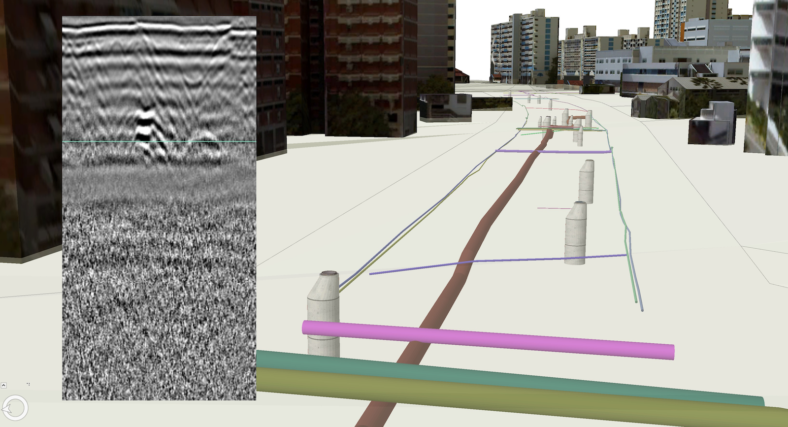
In the case study, the newly collected data from mobile ground penetrating radar was integrated with the existing utility data for 3D modelling. Subsequently, they explored the integration of new collected 3D data, the existing 2D data and cadastral information for land administration of underground utilities to improve the development of the data model for land administration.